
Make a donation
Gear up for your next adventure:
As an Amazon Associate, this site earns from qualifying purchases at no extra cost to you.
Dancing Lake topographic map
Click on the map to display elevation.
Make a donation
Gear up for your next adventure:
As an Amazon Associate, this site earns from qualifying purchases at no extra cost to you.
About this map
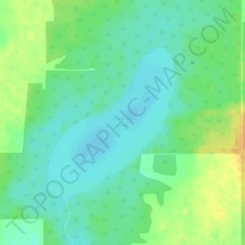
Name: Dancing Lake topographic map, elevation, terrain.
Average elevation: 684 m
Minimum elevation: 673 m
Maximum elevation: 701 m
Make a donation
Gear up for your next adventure:
As an Amazon Associate, this site earns from qualifying purchases at no extra cost to you.
Other topographic maps
Click on a map to view its topography, its elevation and its terrain.
Town of Slave Lake
Canada > Alberta > Municipal District of Lesser Slave River
Average elevation: 589 m
Make a donation
Gear up for your next adventure:
As an Amazon Associate, this site earns from qualifying purchases at no extra cost to you.
Marten Beach Subdivision
Canada > Alberta > Municipal District of Lesser Slave River
Average elevation: 585 m
Marten Beach Subdivision
Canada > Alberta > Municipal District of Lesser Slave River
Average elevation: 585 m