Geolocate

Loch Gair topographic map

Click on the map to display elevation.

About this map

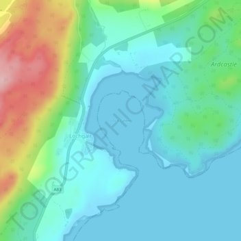
Name: Loch Gair topographic map, elevation, terrain.

Location: Loch Gair, Lochgair, Argyll and Bute, Scotland, United Kingdom (56.05825 -5.33674 56.06961 -5.32074)

Average elevation: 44 m

Minimum elevation: 0 m

Maximum elevation: 181 m

Gear up for your next adventure:

🏕️Camping Hammock - Integrated protection for sleeping between trees
Family Camping Tent - Spacious tent suitable for family camping trips
🥾Hiking Leggings - Comfortable leggings for outdoor activities
🥾Trail Hiking Socks - Comfortable socks to prevent blisters and fatigue
🧥Thermal Fleece Jacket - Versatile insulation for changing mountain temperatures

As an Amazon Associate, this site earns from qualifying purchases at no extra cost to you.