Geolocate

Langdon topographic map

Click on the map to display elevation.

Langdon

Langdon is located 12 km (7.5 mi) east of the City of Calgary at the intersection of Highway 560 (Glenmore Trail) and Highway 797, approximately 6 km (3.7 mi) south of the Trans Canada Highway and 7 km (4.3 mi) north of Highway 22X. It has an elevation of 1,005 m (3,297 ft).

Wikipedia (CC-BY-SA 3.0)

About this map

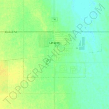
Name: Langdon topographic map, elevation, terrain.

Location: Langdon, Rocky View County, Alberta, Canada (50.95799 -113.72599 50.97955 -113.64409)

Average elevation: 1,007 m

Minimum elevation: 998 m

Maximum elevation: 1,016 m

Rocky View County trails, hiking, mountain biking, running and outdoor activities

Other topographic maps

Click on a map to view its topography, its elevation and its terrain.

Redwood Meadows

Canada > Alberta > Rocky View County

Average elevation: 1,278 m

Cochrane Lake

Canada > Alberta > Rocky View County

Average elevation: 1,292 m

Bragg Creek

Canada > Alberta > Rocky View County

Average elevation: 1,332 m

Jumping Pound

Canada > Alberta > Rocky View County

Average elevation: 1,249 m

Balzac

Canada > Alberta > Rocky View County

Average elevation: 1,088 m

Madden

Canada > Alberta > Rocky View County

Average elevation: 1,151 m

Gear up for your next adventure:

Camping Groundsheet - Protect your tent from moisture and dirt
💧Filtered Water Bottle - Safe drinking water on the go
🦌Outdoor Trail Camera - Monitor wildlife activity near your favorite spots
Tent Footprint - Protect tent floor and increase durability
💡LED Headlamp - Hands-free illumination for night hiking and camping

As an Amazon Associate, this site earns from qualifying purchases at no extra cost to you.