Geolocate

Old Plean topographic map

Click on the map to display elevation.

About this map

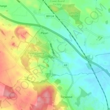
Name: Old Plean topographic map, elevation, terrain.

Location: Old Plean, Plean, Stirling, Scotland, FK7 8BN, United Kingdom (56.03723 -3.88846 56.07723 -3.84846)

Average elevation: 51 m

Minimum elevation: 10 m

Maximum elevation: 124 m

Gear up for your next adventure:

🧦Hiking Liner Socks - Thin base layer to prevent friction and blisters
🕶️Polarized Sunglasses - Reduces glare from snow and water at high elevations
🛰️Satellite Messenger - Emergency communication for areas with no cell service
💡Portable Camping Lamp - Rechargeable lamp for campsite lighting
🧰Survival Kit - Essential gear for emergencies in the wilderness

As an Amazon Associate, this site earns from qualifying purchases at no extra cost to you.