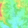
Saint-Loup topographic map
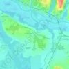
Click on the map to display elevation.
Saint-Loup
Le territoire de Saint-Loup est composé de marais inondables, d'origine fluviatile, qui occupent le tiers du territoire communal, tandis que les vallées humides et les collines dont l'altitude maximale est de 48 mètres s'étendent sur le reste de la commune.
About this map

Name: Saint-Loup topographic map, elevation, terrain.
Average elevation: 26 m
Minimum elevation: -1 m
Maximum elevation: 77 m
Other topographic maps
Click on a map to view its topography, its elevation and its terrain.


Saint-Jean-d'Angély
France > Nouvelle-Aquitaine > Charente-Maritime > Saint-Jean-d'Angély > Saint-Jean-d'Angély
Average elevation: 38 m

La Croix du Pouilloux
France > Nouvelle-Aquitaine > Charente-Maritime > Sainte-Lheurine
Average elevation: 60 m

Plage de Chef de Baie
France > Nouvelle-Aquitaine > Charente-Maritime > La Rochelle
Average elevation: 3 m


Le Berceau
France > Nouvelle-Aquitaine > Charente-Maritime > Meschers-sur-Gironde
Average elevation: 14 m
Le Puits Courant
France > Nouvelle-Aquitaine > Charente-Maritime > Allas-Bocage
Average elevation: 69 m
Saint-Gilles d'Oléron
France > Nouvelle-Aquitaine > Charente-Maritime > Saint-Pierre-d'Oléron
Average elevation: 7 m
La Pommeraie des Gaillards
France > Nouvelle-Aquitaine > Charente-Maritime > Port-d'Envaux
Average elevation: 26 m


Moulin de la Croix
France > Nouvelle-Aquitaine > Charente-Maritime > Saint-Pierre-d'Oléron
Average elevation: 6 m

Champservé le Haut
France > Nouvelle-Aquitaine > Charente-Maritime > Tonnay-Charente
Average elevation: 13 m
Champservé le Bas
France > Nouvelle-Aquitaine > Charente-Maritime > Tonnay-Charente
Average elevation: 11 m
Les Bagnes
France > Nouvelle-Aquitaine > Charente-Maritime > Saint-Pierre-d'Oléron
Average elevation: 5 m
La Sauzaie
France > Nouvelle-Aquitaine > Charente-Maritime > Dampierre-sur-Boutonne
Average elevation: 54 m

Les Biraudes
France > Nouvelle-Aquitaine > Charente-Maritime > Saint-Martin-de-Ré
Average elevation: 7 m
Le Puits d'Asnières
France > Nouvelle-Aquitaine > Charente-Maritime > Asnières-la-Giraud
Average elevation: 59 m
Le Breuil Malmaud
France > Nouvelle-Aquitaine > Charente-Maritime > Saint-Martin-de-Juillers
Average elevation: 65 m
Le Moulin de la Brande
France > Nouvelle-Aquitaine > Charente-Maritime > Aigrefeuille-d'Aunis
Average elevation: 21 m
La Fromagère
France > Nouvelle-Aquitaine > Charente-Maritime > Dompierre-sur-Mer
Average elevation: 21 m
Le Treuil Arnaudeau
France > Nouvelle-Aquitaine > Charente-Maritime > Saint-Médard-d'Aunis
Average elevation: 32 m




Le Maurin
France > Nouvelle-Aquitaine > Charente-Maritime > Saint-Martin-d'Ary
Average elevation: 78 m



Bois des Épinettes
France > Nouvelle-Aquitaine > Charente-Maritime > Nieul-lès-Saintes > Touche-Marteau
Average elevation: 34 m

Château Milan
France > Nouvelle-Aquitaine > Charente-Maritime > Dompierre-sur-Mer
Average elevation: 25 m
Les Pibles
France > Nouvelle-Aquitaine > Charente-Maritime > Saint-Pierre-d'Oléron
Average elevation: 3 m

Saint-Nicolas
France > Nouvelle-Aquitaine > Charente-Maritime > Saint-Dizant-du-Gua
Average elevation: 14 m
Les Landes
France > Nouvelle-Aquitaine > Charente-Maritime > La Chapelle-des-Pots
Average elevation: 65 m

Les Gaules
France > Nouvelle-Aquitaine > Charente-Maritime > Saint-Trojan-les-Bains
Average elevation: 3 m
Moulin de Fief Melin
France > Nouvelle-Aquitaine > Charente-Maritime > La Gaconnière
Average elevation: 3 m
La Menounière
France > Nouvelle-Aquitaine > Charente-Maritime > Saint-Pierre-d'Oléron
Average elevation: 3 m
Les Grandes Versennes
France > Nouvelle-Aquitaine > Charente-Maritime > Port-des-Barques
Average elevation: 2 m
Le Grand Fief Chagnaud
France > Nouvelle-Aquitaine > Charente-Maritime > Port-des-Barques
Average elevation: 2 m
Bas Rhin
France > Nouvelle-Aquitaine > Charente-Maritime > Saint-Clément-des-Baleines
Average elevation: 1 m


Le Coureau
France > Nouvelle-Aquitaine > Charente-Maritime > Saint-Trojan-les-Bains
Average elevation: 3 m