Geolocate

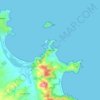
Tsarevo topographic map

Click on the map to display elevation.

About this map

Name: Tsarevo topographic map, elevation, terrain.

Location: Tsarevo, Burgas, Bulgaria (41.97252 27.63626 42.22623 28.03575)

Average elevation: 128 m

Minimum elevation: -1 m

Maximum elevation: 519 m

Other topographic maps

Click on a map to view its topography, its elevation and its terrain.
Aytos

Bulgaria > Burgas

Average elevation: 149 m

Sozopol

Bulgaria > Burgas

Average elevation: 11 m

Zheleznik

Bulgaria > Burgas

Average elevation: 241 m

Brashlyan

Bulgaria > Burgas

Average elevation: 353 m

Gabar

Bulgaria > Burgas

Average elevation: 83 m

Primorsko

Bulgaria > Burgas

Average elevation: 24 m

Skala

Bulgaria > Burgas

Average elevation: 393 m

Tsarevo

Bulgaria > Burgas

Average elevation: 38 m

Nesebar

Bulgaria > Burgas

Average elevation: 4 m

Cape Emine

Bulgaria > Burgas > Emona

Average elevation: 26 m

Slaviantsi

Bulgaria > Burgas

Average elevation: 275 m

Dropla

Bulgaria > Burgas

Average elevation: 181 m

Kiten

Bulgaria > Burgas

Average elevation: 17 m

Sozopol

Bulgaria > Burgas

Average elevation: 11 m

Beronovo

Bulgaria > Burgas

Average elevation: 337 m

Kiten

Bulgaria > Burgas

Average elevation: 17 m

Gear up for your next adventure:

🕶️Polarized Sunglasses - Reduces glare from snow and water at high elevations
🥾Hiking Shorts - Breathable shorts suitable for summer hikes
🥾Waterproof Hiking Boots - Essential footwear for rugged terrain and wet Canadian trails
🕯️Camping Lantern - Illuminates your entire campsite with high-efficiency LEDs
🧥Waterproof Pants - Keep dry during rainy hiking conditions

As an Amazon Associate, this site earns from qualifying purchases at no extra cost to you.