Geolocate

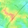
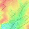
Elmendorf topographic map

Click on the map to display elevation.

About this map

Name: Elmendorf topographic map, elevation, terrain.

Location: Elmendorf, Bexar County, Texas, United States (29.23729 -98.35478 29.27898 -98.28203)

Average elevation: 153 m

Minimum elevation: 126 m

Maximum elevation: 181 m

Other topographic maps

Click on a map to view its topography, its elevation and its terrain.
San Antonio

United States > Texas > Bexar County > San Antonio

Average elevation: 218 m

Sedona

United States > Texas > Bexar County > San Antonio

Average elevation: 301 m

Theis Hill

United States > Texas > Bexar County > San Antonio

Average elevation: 258 m

Mount Smith

United States > Texas > Bexar County

Average elevation: 515 m

Eldorado Lake

United States > Texas > Bexar County > San Antonio

Average elevation: 250 m

Gear up for your next adventure:

⛺Tent Footprint - Protect tent floor and increase durability
🧢Hiking Sun Hat - Wide-brimmed protection for exposed mountain ridges
🥾Hiking Shorts - Breathable shorts suitable for summer hikes
⛺Lightweight Backpacking Tent - Compact tent for efficient hiking trips
🦌Outdoor Trail Camera - Monitor wildlife activity near your favorite spots

As an Amazon Associate, this site earns from qualifying purchases at no extra cost to you.