Geolocate

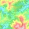
Outur topographic map

Click on the map to display elevation.

About this map

Name: Outur topographic map, elevation, terrain.

Location: Outur, Valdés, Asturias, 33792, Spain (43.52310 -6.63858 43.56564 -6.56618)

Average elevation: 121 m

Minimum elevation: 0 m

Maximum elevation: 466 m

Other topographic maps

Click on a map to view its topography, its elevation and its terrain.
Quintana

Spain > Asturias > Valdés

Average elevation: 96 m

Mones

Spain > Asturias > Valdés

Average elevation: 473 m

Gear up for your next adventure:

🏃Hydration Running Vest - Carry water and maps close to your body for speed
🧳Compression Sacks - Maximize space in your backpack by shrinking gear
🧥Softshell Hiking Jacket - The perfect balance of wind protection and breathability
💡LED Headlamp - Hands-free illumination for night hiking and camping
🧤Insulated Winter Gloves - Heavy-duty protection for sub-zero Canadian adventures

As an Amazon Associate, this site earns from qualifying purchases at no extra cost to you.