
Dalkeith topographic map
Click on the map to display elevation.
About this map
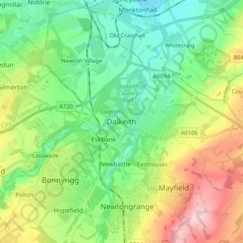
Name: Dalkeith topographic map, elevation, terrain.
Location: Dalkeith, Midlothian, Scotland, EH22 1HZ, United Kingdom (55.85434 -3.11004 55.93434 -3.03004)
Average elevation: 95 m
Minimum elevation: 9 m
Maximum elevation: 270 m
Other topographic maps
Click on a map to view its topography, its elevation and its terrain.
Straiton Pond Local Nature Reserve
United Kingdom > Scotland > Midlothian > Loanhead
Average elevation: 131 m