Geolocate

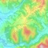
Acquasparta topographic map

Click on the map to display elevation.

About this map

Name: Acquasparta topographic map, elevation, terrain.

Location: Acquasparta, Terni, Umbria, 05021, Italy (42.64118 12.46253 42.74557 12.62730)

Average elevation: 445 m

Minimum elevation: 187 m

Maximum elevation: 1,012 m

Other topographic maps

Click on a map to view its topography, its elevation and its terrain.

Monte Torre Maggiore

Italy > Umbria > Terni > Terni

Average elevation: 867 m

Colleabramo

Italy > Umbria > Terni > Narni > Vigne

Average elevation: 221 m

San Liberatore

Italy > Umbria > Terni > Terni > Collestatte

Average elevation: 318 m

Cesi

Italy > Umbria > Terni > Terni

Cesi is a frazione of the Italian comune of Terni, in the province of Terni, southern Umbria, Italy. The small borgo, which retains its late-medieval aspect, set among olive groves, lies "stretched out lengthwise along a narrow contour on the slopes of M. Torre Maggiore," about 18 km north of Terni at an…

Average elevation: 447 m
Montecampano

Italy > Umbria > Terni > Amelia

Average elevation: 219 m

Gear up for your next adventure:

🧥Softshell Hiking Jacket - The perfect balance of wind protection and breathability
🔭Compact Monocular - One-handed bird watching and trail spotting
💧Hydration Bladder - Hands-free hydration solution for long treks
🧊Insulated Water Bottle - Keeps drinks cold in summer and prevents freezing in winter
🧢Outdoor Visor - Breathable visor for sunny hikes

As an Amazon Associate, this site earns from qualifying purchases at no extra cost to you.