Geolocate

Monte Torre Maggiore topographic map

Click on the map to display elevation.

About this map

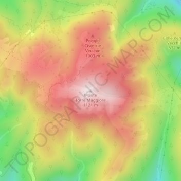
Name: Monte Torre Maggiore topographic map, elevation, terrain.

Location: Monte Torre Maggiore, Terni, Umbria, 05100, Italy (42.62840 12.60281 42.62850 12.60291)

Average elevation: 867 m

Minimum elevation: 552 m

Maximum elevation: 1,114 m

Gear up for your next adventure:

🧢Hiking Sun Hat - Wide-brimmed protection for exposed mountain ridges
Camping Coffee Maker - Brew fresh coffee anywhere on the topographic map
🦶Hiking Shoe Insoles - Added support for high arches and long days on feet
🧥Packable Rain Jacket - Breathable waterproof layer for unpredictable weather
🥾Mountaineering Boots - Supportive boots for climbing and high-altitude hiking

As an Amazon Associate, this site earns from qualifying purchases at no extra cost to you.