Geolocate

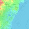
Kennebunk topographic map

Click on the map to display elevation.

About this map

Name: Kennebunk topographic map, elevation, terrain.

Location: Kennebunk, York County, Maine, 04043, United States (43.28582 -70.67011 43.45801 -70.46954)

Average elevation: 27 m

Minimum elevation: -5 m

Maximum elevation: 94 m

Other topographic maps

Click on a map to view its topography, its elevation and its terrain.

Boon Island

United States > Maine > York County > York

Average elevation: 0 m

Lake Sherburne

United States > Maine > York County > Waterboro

Average elevation: 142 m

Wells Beach

United States > Maine > York County > Wells

Average elevation: 1 m

Jamaica Island

United States > Maine > York County > Kittery

Average elevation: 31 m

Parsons Beach

United States > Maine > York County > Kennebunk

Average elevation: 3 m

Crescent Beach

United States > Maine > York County > Kittery

Average elevation: 5 m

Rotary Park

United States > Maine > York County > Kennebunk > Kennebunk

Average elevation: 18 m

Mount Agamenticus

United States > Maine > York County > York

Average elevation: 92 m

Boon Island

United States > Maine > York County > York

Average elevation: 0 m

Mount Agamenticus

United States > Maine > York County > York

Average elevation: 92 m

Rotary Park

United States > Maine > York County > Kennebunk > Kennebunk

Average elevation: 18 m

Ogunquit Beach

United States > Maine > York County > Ogunquit

Average elevation: 11 m

Holdsworth Park

United States > Maine > York County > Sanford

Average elevation: 130 m

Gear up for your next adventure:

🧣Merino Neck Gaiter - Protects against wind, sun, and cold at high altitudes
🕶️Polarized Sunglasses - Protect your eyes with durable polarized lenses
👟Trail Running Shoes - Agile footwear for fast-paced topographic exploration
💧Filtered Water Bottle - Safe drinking water on the go
🧭GPS Tracker - Track your location in remote areas safely

As an Amazon Associate, this site earns from qualifying purchases at no extra cost to you.