Geolocate

Crescent Beach topographic map

Click on the map to display elevation.

About this map

Name: Crescent Beach topographic map, elevation, terrain.

Location: Crescent Beach, Kittery, York County, Maine, United States (43.08337 -70.66586 43.08608 -70.66150)

Average elevation: 5 m

Minimum elevation: -2 m

Maximum elevation: 22 m

Other topographic maps

Click on a map to view its topography, its elevation and its terrain.
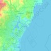
Jamaica Island

United States > Maine > York County > Kittery

Average elevation: 31 m

Isles of Shoals

United States > Maine > York County > Kittery

Average elevation: 0 m

Gear up for your next adventure:

🛰️Satellite Messenger - Emergency communication for areas with no cell service
⛺Bushcraft Tarp - Versatile emergency shelter or gear protection
🧼Travel Hand Sanitizer - Keep hands clean when water is scarce
🏕️Camping Hammock - Integrated protection for sleeping between trees
🧴Insect Repellent - Protect yourself from bugs during outdoor adventures

As an Amazon Associate, this site earns from qualifying purchases at no extra cost to you.