Geolocate

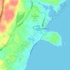
Mount Agamenticus topographic map

Click on the map to display elevation.

About this map

Name: Mount Agamenticus topographic map, elevation, terrain.

Location: Mount Agamenticus, York, York County, Maine, 03980, United States (43.22306 -70.69221 43.22316 -70.69211)

Average elevation: 92 m

Minimum elevation: 41 m

Maximum elevation: 208 m

Other topographic maps

Click on a map to view its topography, its elevation and its terrain.

Boon Island

United States > Maine > York County > York

Average elevation: 0 m

York River

United States > Maine > York County > York

Average elevation: 31 m

Cape Neddick

United States > Maine > York County > York > Cape Neddick

Average elevation: 13 m

Cape Neddick

United States > Maine > York County > York > Cape Neddick

Average elevation: 13 m

Boon Island

United States > Maine > York County > York

Average elevation: 0 m

Gear up for your next adventure:

👟Sport Hiking Sandals - Breathable footwear for water crossings and camp rest
🧦Merino Wool Socks - Moisture-wicking comfort for long-distance hiking
🛏️Camping Sleeping Mat - Comfortable mats for sleeping outdoors
🎒Hiking Daypack - Lightweight and durable backpacks for day trips and excursions
🧥Fleece Jacket - Warm and lightweight jacket for layering

As an Amazon Associate, this site earns from qualifying purchases at no extra cost to you.