
IV. kerület topographic map
Interactive map
Click on the map to display elevation.
About this map
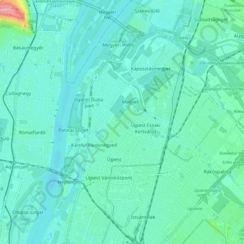
Name: IV. kerület topographic map, elevation, terrain.
Location: IV. kerület, Budapest, Hungría Central, Hungría (47.54232 19.06720 47.61315 19.12346)
Average elevation: 111 m
Minimum elevation: 94 m
Maximum elevation: 208 m
Other topographic maps
Click on a map to view its topography, its elevation and its terrain.
II. kerület
II. kerület, Budapest, Hungría Central, Hungría
Average elevation: 252 m
VI. kerület
VI. kerület, Budapest, Hungría Central, Hungría
Average elevation: 114 m