Geolocate

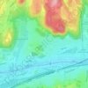
Ramberget topographic map

Click on the map to display elevation.

About this map

Name: Ramberget topographic map, elevation, terrain.

Location: Ramberget, Gothenburg, Göteborgs Stad, Västra Götaland County, 417 13, Sweden (57.71453 11.93615 57.71463 11.93625)

Average elevation: 15 m

Minimum elevation: -2 m

Maximum elevation: 83 m

Other topographic maps

Click on a map to view its topography, its elevation and its terrain.

Olivedal

Sweden > Västra Götaland County > Gothenburg

Average elevation: 26 m

Utby

Sweden > Västra Götaland County > Gothenburg

Average elevation: 41 m

Heden

Sweden > Västra Götaland County > Gothenburg

Average elevation: 24 m

Gear up for your next adventure:

🧶550 Survival Paracord - Versatile utility cord for emergency repairs and rigging
🎒Hiking Daypack - Lightweight and durable backpacks for day trips and excursions
🥾Hiking Shorts - Breathable shorts suitable for summer hikes
🕯️Camping Lantern - Illuminates your entire campsite with high-efficiency LEDs
🩹Moleskin Blister Pads - Direct protection for painful foot pressure points

As an Amazon Associate, this site earns from qualifying purchases at no extra cost to you.