Geolocate

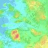
Olivedal topographic map

Click on the map to display elevation.

About this map

Name: Olivedal topographic map, elevation, terrain.

Location: Olivedal, Centrum, Gothenburg, Göteborgs Stad, Västra Götaland County, Sweden (57.69046 11.94586 57.70410 11.95812)

Average elevation: 26 m

Minimum elevation: -2 m

Maximum elevation: 83 m

Other topographic maps

Click on a map to view its topography, its elevation and its terrain.

Björsbo

Sweden > Västra Götaland County > Gothenburg

Average elevation: 98 m

Skra Bro

Sweden > Västra Götaland County > Gothenburg

Average elevation: 15 m

Äspered

Sweden > Västra Götaland County > Gothenburg

Average elevation: 83 m

Gear up for your next adventure:

💡LED Headlamp - Hands-free illumination for night hiking and camping
🧦Merino Wool Socks - Moisture-wicking comfort for long-distance hiking
🔭Compact Binoculars - Lightweight optics for scouting trails and wildlife
🔦UV Flashlight - Detect minerals or specific insects in the dark
📷Outdoor Action Camera - Capture high-elevation views and rugged adventures

As an Amazon Associate, this site earns from qualifying purchases at no extra cost to you.