
Njaba topographic map
Interactive map
Click on the map to display elevation.
About this map
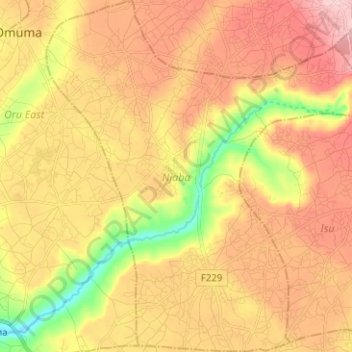
Name: Njaba topographic map, elevation, terrain.
Location: Njaba, Imo State, Nigeria (5.64318 6.95579 5.76794 7.07482)
Average elevation: 134 m
Minimum elevation: 24 m
Maximum elevation: 221 m
Other topographic maps
Click on a map to view its topography, its elevation and its terrain.