
Orsu topographic map
Interactive map
Click on the map to display elevation.
About this map
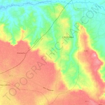
Name: Orsu topographic map, elevation, terrain.
Location: Orsu, Imo State, Nigeria (5.79564 6.91556 5.90519 7.01588)
Average elevation: 116 m
Minimum elevation: 32 m
Maximum elevation: 208 m
Other topographic maps
Click on a map to view its topography, its elevation and its terrain.