

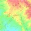
Hagley topographic map
Click on the map to display elevation.
About this map

Name: Hagley topographic map, elevation, terrain.
Location: Hagley, Bromsgrove, Worcestershire, England, United Kingdom (52.40927 -2.16778 52.44527 -2.07990)
Average elevation: 125 m
Minimum elevation: 62 m
Maximum elevation: 295 m
Other topographic maps
Click on a map to view its topography, its elevation and its terrain.
Lickey Hills Country Park
United Kingdom > England > Worcestershire > Bromsgrove > Cofton Hackett CP
Average elevation: 209 m


Sanders Park
United Kingdom > England > Worcestershire > Bromsgrove > Bromsgrove > Lickey End
Average elevation: 96 m
