Geolocate

Praça Vico Barbieri topographic map

Click on the map to display elevation.

About this map

Other topographic maps

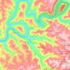
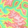
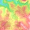
Click on a map to view its topography, its elevation and its terrain.

Centro

Brasil > Rio Grande do Sul > Bento Gonçalves

Average elevation: 626 m

Municipal

Brasil > Rio Grande do Sul > Bento Gonçalves

Average elevation: 563 m

Aparecida

Brasil > Rio Grande do Sul > Bento Gonçalves

Average elevation: 579 m

Tuiuty

Brasil > Rio Grande do Sul > Bento Gonçalves

Average elevation: 385 m

Gear up for your next adventure:

👟Sport Hiking Sandals - Breathable footwear for water crossings and camp rest
📷Outdoor Action Camera - Capture high-elevation views and rugged adventures
🥾Hiking Shoes - Durable and comfortable shoes for trail hiking
🚲MTB Frame Bag - Carry tools and maps directly on your bicycle frame
⛺Lightweight Backpacking Tent - Compact tent for efficient hiking trips

As an Amazon Associate, this site earns from qualifying purchases at no extra cost to you.