Geolocate

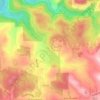
São Valentin topographic map

Click on the map to display elevation.

About this map

Name: São Valentin topographic map, elevation, terrain.

Location: São Valentin, Tuiuty, Bento Gonçalves, Rio Grande do Sul, Região Sul, Brasil (-29.12454 -51.56232 -29.09787 -51.52203)

Average elevation: 566 m

Minimum elevation: 333 m

Maximum elevation: 653 m

Other topographic maps

Click on a map to view its topography, its elevation and its terrain.

Gear up for your next adventure:

🗺️Topographic Maps - Detailed maps to explore trails, mountains, and wilderness areas
🕶️Polarized Sunglasses - Reduces glare from snow and water at high elevations
🧥Packable Rain Jacket - Breathable waterproof layer for unpredictable weather
🧥Softshell Jacket - Windproof and breathable jacket for hiking
🥾Trekking Poles - Adjustable trekking poles to reduce knee stress and improve stability

As an Amazon Associate, this site earns from qualifying purchases at no extra cost to you.