Geolocate

Faria Lemos topographic map

Click on the map to display elevation.

About this map
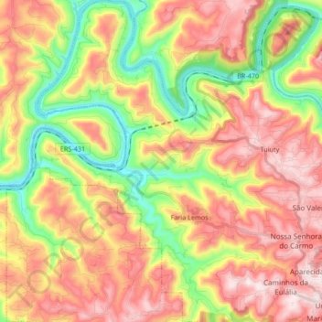
Name: Faria Lemos topographic map, elevation, terrain.

Location: Faria Lemos, Bento Gonçalves, Rio Grande do Sul, Região Sul, 95713-000, Brasil (-29.15841 -51.68179 -29.01315 -51.56149)

Average elevation: 379 m

Minimum elevation: 65 m

Maximum elevation: 684 m

Other topographic maps

Click on a map to view its topography, its elevation and its terrain.

Gear up for your next adventure:

🔦LED Headtorch - Bright and durable light for night activities
⛺Lightweight Camping Tent - Portable shelter optimized for Canadian backcountry camping
🧊Portable Cooler - Keep food and drinks cold during outdoor adventures
🛶Kayak Dry Bag - Waterproof storage for kayaking adventures
💧Collapsible Water Bottle - Space-saving water bottle for outdoor activities

As an Amazon Associate, this site earns from qualifying purchases at no extra cost to you.