
Coleville topographic map
Click on the map to display elevation.
Coleville
Coleville is an unincorporated community and census-designated place (CDP) in Mono County, California, United States. It is located at an elevation of 5,141 feet (1,567 m) in the Antelope Valley on the West Walker River. The population was 419 at the 2020 census, down from 495 at the 2010 census.
About this map
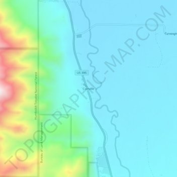
Name: Coleville topographic map, elevation, terrain.
Location: Coleville, Mono County, California, United States (38.54630 -119.52711 38.58630 -119.48711)
Average elevation: 1,683 m
Minimum elevation: 1,546 m
Maximum elevation: 2,272 m
Other topographic maps
Click on a map to view its topography, its elevation and its terrain.
Owens River Headwaters Wilderness
United States > California > Mono County > Mammoth Lakes
Average elevation: 2,683 m