Geolocate

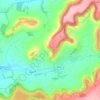
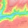
Througham topographic map

Click on the map to display elevation.

About this map

Name: Througham topographic map, elevation, terrain.

Location: Througham, Bisley-with-Lypiatt, Stroud, Gloucestershire, England, GL6 7HG, United Kingdom (51.75100 -2.13688 51.79100 -2.09688)

Average elevation: 229 m

Minimum elevation: 136 m

Maximum elevation: 275 m

Other topographic maps

Click on a map to view its topography, its elevation and its terrain.

Pitchcombe

United Kingdom > England > Gloucestershire > Stroud

Average elevation: 146 m

Slimbridge

United Kingdom > England > Gloucestershire > Stroud

Average elevation: 14 m

Chalford

United Kingdom > England > Gloucestershire > Stroud > Chalford

Average elevation: 170 m

Uley

United Kingdom > England > Gloucestershire > Stroud

Average elevation: 140 m

Stinchcombe

United Kingdom > England > Gloucestershire > Stroud

Average elevation: 78 m

Arlingham

United Kingdom > England > Gloucestershire > Stroud

Average elevation: 14 m

Kingswood

United Kingdom > England > Gloucestershire > Stroud

Average elevation: 65 m

Woodchester

United Kingdom > England > Gloucestershire > Stroud

Average elevation: 129 m

Cam

United Kingdom > England > Gloucestershire > Stroud > Cam

Average elevation: 69 m

Gear up for your next adventure:

🪑Ultralight Camping Stool - Compact seating for rest stops during long hikes
🗺️Topographic Maps - Detailed maps to explore trails, mountains, and wilderness areas
🧣Merino Neck Gaiter - Protects against wind, sun, and cold at high altitudes
🌡️Emergency Mylar Blankets - Compact thermal protection for unexpected nights outdoors
🥫Freeze-Dried Meals - Lightweight, high-calorie nutrition for multi-day treks

As an Amazon Associate, this site earns from qualifying purchases at no extra cost to you.