
Chalford topographic map
Click on the map to display elevation.
About this map
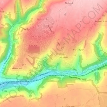
Name: Chalford topographic map, elevation, terrain.
Location: Chalford, Stroud, Gloucestershire, England, United Kingdom (51.71868 -2.17989 51.73559 -2.12816)
Average elevation: 170 m
Minimum elevation: 62 m
Maximum elevation: 236 m
Other topographic maps
Click on a map to view its topography, its elevation and its terrain.
River Frome
United Kingdom > England > Gloucestershire > Stroud > Chalford > Chalford Hill
Average elevation: 163 m