
ولسوالی چاهآب topographic map
Interactive map
Click on the map to display elevation.
About this map
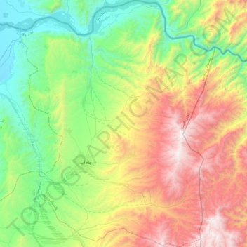
Name: ولسوالی چاهآب topographic map, elevation, terrain.
Location: ولسوالی چاهآب, Wilaya Tachar, Afghanistan (37.28394 69.70464 37.61500 70.03457)
Average elevation: 1,269 m
Minimum elevation: 490 m
Maximum elevation: 2,608 m
Other topographic maps
Click on a map to view its topography, its elevation and its terrain.
ولسوالی اشکمش
ولسوالی اشکمش, Wilaya Tachar, Afghanistan
Average elevation: 1,693 m
ولسوالی ورسج
ولسوالی ورسج, Wilaya Tachar, Afghanistan
Average elevation: 3,935 m