
Tyndall Glacier topographic map
Interactive map
Click on the map to display elevation.
About this map
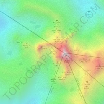
Name: Tyndall Glacier topographic map, elevation, terrain.
Location: Tyndall Glacier, Nyeri, Central Kenya, Kenya (-0.15334 37.30439 -0.15035 37.30673)
Average elevation: 4,526 m
Minimum elevation: 4,151 m
Maximum elevation: 5,149 m
Other topographic maps
Click on a map to view its topography, its elevation and its terrain.
Nyeri
Kenya > Nyeri > Nyeri Central
Nyeri, Nyeri Central, Nyeri, Central Kenya, Kenya
Average elevation: 1,796 m