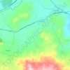
Tocuaro topographic map
Click on the map to display elevation.
About this map

Name: Tocuaro topographic map, elevation, terrain.
Location: Tocuaro, Erongarícuaro, Michoacán, Mexico (19.51889 -101.71416 19.55889 -101.67416)
Average elevation: 2,069 m
Minimum elevation: 2,038 m
Maximum elevation: 2,196 m
Other topographic maps
Click on a map to view its topography, its elevation and its terrain.

Vista Hermosa
The municipality of Vista Hermosa is located at an elevation between 1,600 and 1,700 metres (5,200–5,600 ft) in the Bajío region in northwestern Michoacán. It borders the Michoacanese municipalities of Tanhuato to the east, Ixtlán to the southeast, Pajacuarán to the southwest, and Briseñas to the west.…
Average elevation: 1,541 m

San Lucas
It has an average altitude of 300 meters above sea level. Its landscape is composed of the Transversal volcanic system, the Balsas depression; Silla, Cruz and Picacho hills; La bolita, Cutzamala, and the Balsas rivers; San Lucas and the Chumbitaro creeks. The climate is tropical, dry steppe, with temperatures…
Average elevation: 459 m


Ixtlán
It has an average altitude of 1,530 meters above sea level, being on the north of the Trans-Mexican Volcanic Belt and the Lerma-Chapala Depression. There are some elevations including the hills called El Comalito, Divisadero, Gordo, Encinal and Coyote.
Average elevation: 1,603 m


Tanhuato
The municipality of Tanhuato is located at an elevation between 1,600 and 2,000 metres (5,200–6,600 ft) in the Bajío region in northwestern Michoacán. It borders the Michoacanese municipalities of Yurécuaro to the east, Ecuandureo to the southeast, Ixtlán to the southwest, and Vista Hermosa to the west.…
Average elevation: 1,590 m


Zinapécuaro
The flat western part of the municipality lies in the Lake Cuitzeo basin. Along the basin's eastern edge are a series of hills and ridges where the municipal seat is located. The Ucareo Valley in the eastern part of the municipality comprises part of an ancient caldera, and is over 700 metres (2,300 ft) higher…
Average elevation: 2,257 m
Cojumatlán de Régules
The municipality of Cojumatlán de Régules is located in the Trans-Mexican Volcanic Belt in northwest Michoacán at an altitude between 1,600 and 2,400 metres (5,200–7,900 ft). It borders the Michoacano municipalities of Venustiano Carranza to the east, Sahuayo to the southeast, Jiquilpan to the south,…
Average elevation: 1,842 m





Aquila
Aquila (Spanish pronunciation: [aˈkila]) is a town in the southwest part of the Mexican state of Michoacán. It is the municipal seat for the municipality of Aquila. It is 23 mi/43 km southeast of Tecoman. Its population was 1,915 in 2002. It is located at Latitude: 18°35'N Longitude: 103°31'W and at…
Average elevation: 519 m

Churintzio
The municipality of Churintzio is located in northern Michoacán at an altitude between 1,700 and 2,500 metres (5,600–8,200 ft). It borders the municipalities of Ecuandureo to the west, La Piedad to the north, Zináparo to the northeast, Penjamillo to the southeast, and Tlazazalca to the south. The…
Average elevation: 1,903 m