Geolocate

Santa Ana Maya topographic map

Click on the map to display elevation.

About this map

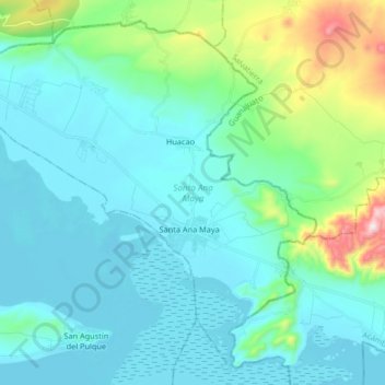
Name: Santa Ana Maya topographic map, elevation, terrain.

Location: Santa Ana Maya, Michoacán, Mexico (19.95317 -101.13204 20.09195 -100.96733)

Average elevation: 1,940 m

Minimum elevation: 1,828 m

Maximum elevation: 2,494 m

Gear up for your next adventure:

🧰Multitool Knife - Compact and versatile tool for outdoor use
🧴Outdoor Sunscreen - High SPF protection for high-altitude UV exposure
🥾Approach Shoes - Shoes designed for climbing approaches and rugged trails
Lightweight Camping Tent - Portable shelter optimized for Canadian backcountry camping
🧳Compression Sacks - Maximize space in your backpack by shrinking gear

As an Amazon Associate, this site earns from qualifying purchases at no extra cost to you.