Geolocate

Jiquilpan topographic map

Click on the map to display elevation.

About this map

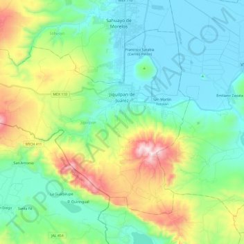
Name: Jiquilpan topographic map, elevation, terrain.

Location: Jiquilpan, Michoacán, Mexico (19.88327 -102.88926 20.05165 -102.65363)

Average elevation: 1,831 m

Minimum elevation: 1,523 m

Maximum elevation: 2,564 m

Other topographic maps

Click on a map to view its topography, its elevation and its terrain.

Gear up for your next adventure:

🥾Approach Shoes - Shoes designed for climbing approaches and rugged trails
💡Compact LED Flashlight - Powerful and portable flashlight for outdoor use
👟Trail Running Shoes - Agile footwear for fast-paced topographic exploration
🧭GPS Tracker - Track your location in remote areas safely
🚲Handlebar Phone Mount - View topographic-map.com live while cycling

As an Amazon Associate, this site earns from qualifying purchases at no extra cost to you.