Geolocate

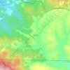
Independence topographic map

Click on the map to display elevation.

About this map
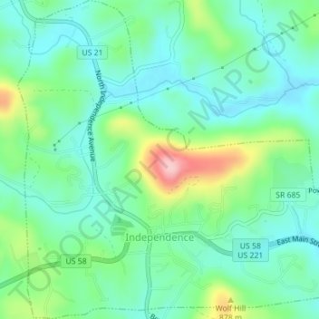
Name: Independence topographic map, elevation, terrain.

Location: Independence, Grayson County, Virginia, 24348, United States (36.61515 -81.16653 36.64319 -81.13248)

Average elevation: 817 m

Minimum elevation: 767 m

Maximum elevation: 950 m

Other topographic maps

Click on a map to view its topography, its elevation and its terrain.
Whitetop

United States > Virginia > Grayson County

Average elevation: 1,107 m

Volney

United States > Virginia > Grayson County

Average elevation: 891 m

Comers Rock

United States > Virginia > Grayson County

Average elevation: 1,009 m

Elk Creek

United States > Virginia > Grayson County

Average elevation: 809 m

Whitetop

United States > Virginia > Grayson County

Average elevation: 1,107 m

Elk Creek

United States > Virginia > Grayson County

Average elevation: 809 m

Carsonville

United States > Virginia > Grayson County

Average elevation: 786 m

Rugby

United States > Virginia > Grayson County

Average elevation: 986 m

Gear up for your next adventure:

👖Convertible Hiking Pants - Zip-off legs to adapt to changing weather conditions
🧶550 Survival Paracord - Versatile utility cord for emergency repairs and rigging
🚲MTB Frame Bag - Carry tools and maps directly on your bicycle frame
🕶️Polarized Sunglasses - Reduces glare from snow and water at high elevations
🧥Waterproof Hiking Jacket - Protect yourself from rain and wind while hiking

As an Amazon Associate, this site earns from qualifying purchases at no extra cost to you.