Geolocate

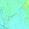
Wawa topographic map

Click on the map to display elevation.

About this map

Name: Wawa topographic map, elevation, terrain.

Location: Wawa, Balagtas, Bulacan, Central Luzon, Philippines (14.81188 120.90191 14.82608 120.91320)

Average elevation: 4 m

Minimum elevation: 1 m

Maximum elevation: 7 m

Other topographic maps

Click on a map to view its topography, its elevation and its terrain.
Balagtas River

Philippines > Bulacan > Balagtas

Average elevation: 6 m

Santol

Philippines > Bulacan > Balagtas

Average elevation: 8 m

Dalig

Philippines > Bulacan > Balagtas

Average elevation: 7 m

Gear up for your next adventure:

🧦Merino Wool Socks - Moisture-wicking comfort for long-distance hiking
🚲Handlebar Phone Mount - View topographic-map.com live while cycling
🥤Collapsible Travel Cup - Saves space and weight in your mess kit
🥾Hiking Shorts - Breathable shorts suitable for summer hikes
🧭GPS Handheld Device - Reliable GPS navigation for outdoor adventures

As an Amazon Associate, this site earns from qualifying purchases at no extra cost to you.