Geolocate

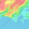
Aberthin topographic map

Click on the map to display elevation.

About this map

Name: Aberthin topographic map, elevation, terrain.

Location: Aberthin, Vale of Glamorgan, Wales, CF71 7LE, United Kingdom (51.44717 -3.44936 51.48717 -3.40936)

Average elevation: 67 m

Minimum elevation: 17 m

Maximum elevation: 134 m

Other topographic maps

Click on a map to view its topography, its elevation and its terrain.
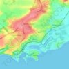
Penarth

United Kingdom > Wales > Vale of Glamorgan

Average elevation: 17 m

Barry

United Kingdom > Wales > Vale of Glamorgan

Average elevation: 29 m

Dinas Powys

United Kingdom > Wales > Vale of Glamorgan

Average elevation: 30 m

St. Athan

United Kingdom > Wales > Vale of Glamorgan > St Athan

Average elevation: 30 m

Romilly Park

United Kingdom > Wales > Vale of Glamorgan > Barry

Average elevation: 26 m

Barry

United Kingdom > Wales > Vale of Glamorgan

Average elevation: 29 m

Barry

United Kingdom > Wales > Vale of Glamorgan

Average elevation: 29 m

Barry

United Kingdom > Wales > Vale of Glamorgan

Average elevation: 29 m

Gear up for your next adventure:

🥾Mountaineering Boots - Supportive boots for climbing and high-altitude hiking
🧼Biodegradable Camp Soap - Environmentally friendly cleaning for gear and body
⛺Bushcraft Tarp - Versatile emergency shelter or gear protection
🥽Outdoor Goggles - Protective eyewear for outdoor activities
🧤Insulated Winter Gloves - Heavy-duty protection for sub-zero Canadian adventures

As an Amazon Associate, this site earns from qualifying purchases at no extra cost to you.