Geolocate

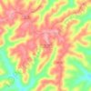
Adair County topographic map

Click on the map to display elevation.

About this map

Name: Adair County topographic map, elevation, terrain.

Location: Adair County, Missouri, United States (40.03709 -92.85631 40.34649 -92.34531)

Average elevation: 274 m

Minimum elevation: 220 m

Maximum elevation: 322 m

Other topographic maps

Click on a map to view its topography, its elevation and its terrain.
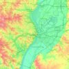
Saint Louis

United States > Missouri > Saint Louis

Average elevation: 151 m

Catawissa

United States > Missouri > Franklin County

Average elevation: 168 m

Richie

United States > Missouri > Buchanan County

Average elevation: 325 m

Rimby

United States > Missouri > Polk County

Average elevation: 305 m

Greenstreet

United States > Missouri > Franklin County

Average elevation: 215 m

Ridgedale

United States > Missouri > Taney County

Average elevation: 387 m

Chesapeake

United States > Missouri > Lawrence County

Average elevation: 389 m

Wasley Lake Dam

United States > Missouri > Boone County

Average elevation: 271 m

Gear up for your next adventure:

🥾Lightweight Hiking Boots - Boots for comfort and mobility on long hikes
🚲Handlebar Phone Mount - View topographic-map.com live while cycling
🧢Sun Hat - Wide-brim hat for sun protection
⛺Bushcraft Tarp - Versatile emergency shelter or gear protection
🔦LED Headlamp - Hands-free lighting for early morning starts or late finishes

As an Amazon Associate, this site earns from qualifying purchases at no extra cost to you.