Geolocate

Catawissa topographic map

Click on the map to display elevation.

About this map

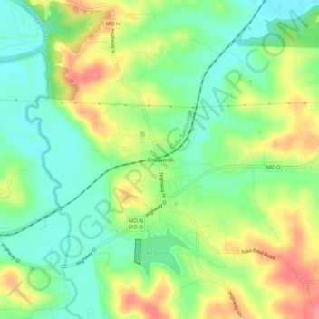
Name: Catawissa topographic map, elevation, terrain.

Location: Catawissa, Franklin County, Missouri, 63015, United States (38.40478 -90.80263 38.44478 -90.76263)

Average elevation: 168 m

Minimum elevation: 132 m

Maximum elevation: 219 m

Other topographic maps

Click on a map to view its topography, its elevation and its terrain.

St. Clair

United States > Missouri > Franklin County

Average elevation: 212 m

Gear up for your next adventure:

🔦UV Flashlight - Detect minerals or specific insects in the dark
🎒Hiking Backpack - Lightweight and ergonomic backpacks for day hikes or multi-day treks
🚑Survival Whistle - Signal for help across long distances in mountains
🧭GPS Handheld Device - Reliable GPS navigation for outdoor adventures
🥾Approach Shoes - Shoes designed for climbing approaches and rugged trails

As an Amazon Associate, this site earns from qualifying purchases at no extra cost to you.