
Ruckinge topographic map
Click on the map to display elevation.
About this map
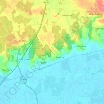
Name: Ruckinge topographic map, elevation, terrain.
Location: Ruckinge, Ashford, Kent, England, United Kingdom (51.03699 0.83993 51.10202 0.90112)
Average elevation: 23 m
Minimum elevation: -1 m
Maximum elevation: 73 m
Other topographic maps
Click on a map to view its topography, its elevation and its terrain.
Ham Street Woods National Nature Reserve
United Kingdom > England > Kent > Ashford > Hamstreet
Average elevation: 31 m
Wye National Nature Reserve
United Kingdom > England > Kent > Ashford > Brook
Average elevation: 123 m