Geolocate

Whispering Pines Ranch topographic map

Click on the map to display elevation.

About this map

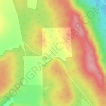
Name: Whispering Pines Ranch topographic map, elevation, terrain.

Location: Whispering Pines Ranch, Municipal District of Bighorn, Alberta, Canada (51.52387 -114.80403 51.54387 -114.78403)

Average elevation: 1,426 m

Minimum elevation: 1,357 m

Maximum elevation: 1,477 m

Municipal District of Bighorn trails, hiking, mountain biking, running and outdoor activities

Other topographic maps

Click on a map to view its topography, its elevation and its terrain.

Gap Lake

Canada > Alberta > Municipal District of Bighorn

Average elevation: 1,424 m

Gear up for your next adventure:

🥫Freeze-Dried Meals - Lightweight, high-calorie nutrition for multi-day treks
🔦LED Headlamp - Hands-free lighting for early morning starts or late finishes
🧦Outdoor Socks - Durable socks designed for hiking and outdoor sports
🥾All-Terrain Hiking Boots - Versatile boots for varied hiking conditions
🧥Ultralight Puffy Jacket - Maximum warmth that packs down to the size of an orange

As an Amazon Associate, this site earns from qualifying purchases at no extra cost to you.