Geolocate

Frö topographic map

Click on the map to display elevation.

About this map

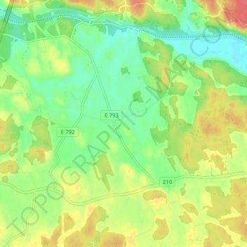
Name: Frö topographic map, elevation, terrain.

Location: Frö, Norrköpings kommun, Östergötland County, 617 92, Sweden (58.47284 16.00849 58.51284 16.04849)

Average elevation: 48 m

Minimum elevation: 25 m

Maximum elevation: 77 m

Other topographic maps

Click on a map to view its topography, its elevation and its terrain.

Kinda kommun

Sweden > Östergötland County

Average elevation: 133 m

Nässja

Sweden > Östergötland County

Average elevation: 91 m

Navestad

Sweden > Östergötland County > Norrköping

Average elevation: 34 m

Vadstena

Sweden > Östergötland County

Average elevation: 98 m

Illern

Sweden > Östergötland County > Linköping

Average elevation: 72 m

Mjölby kommun

Sweden > Östergötland County

Average elevation: 123 m

Halgen

Sweden > Östergötland County

Average elevation: 88 m

Lindö

Sweden > Östergötland County > Lindö

Average elevation: 8 m

Järstad

Sweden > Östergötland County

Average elevation: 82 m

Boxholms kommun

Sweden > Östergötland County

Average elevation: 169 m

Gear up for your next adventure:

🏕️Camping Hammock - Integrated protection for sleeping between trees
🧴Outdoor Sunscreen - High SPF protection for high-altitude UV exposure
🧥Insulated Jacket - Keep warm in cold outdoor conditions
🥾Trail Hiking Socks - Comfortable socks to prevent blisters and fatigue
🥾Light Trekking Boots - Supportive boots for multi-day treks

As an Amazon Associate, this site earns from qualifying purchases at no extra cost to you.