Geolocate

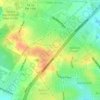
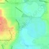
China Grove topographic map

Click on the map to display elevation.

About this map

Name: China Grove topographic map, elevation, terrain.

Location: China Grove, Bexar County, Texas, United States (29.37360 -98.36076 29.41456 -98.32020)

Average elevation: 197 m

Minimum elevation: 175 m

Maximum elevation: 216 m

Other topographic maps

Click on a map to view its topography, its elevation and its terrain.
San Antonio

United States > Texas > Bexar County > San Antonio

Average elevation: 218 m

Sedona

United States > Texas > Bexar County > San Antonio

Average elevation: 301 m

Theis Hill

United States > Texas > Bexar County > San Antonio

Average elevation: 258 m

Mount Smith

United States > Texas > Bexar County

Average elevation: 515 m

Eldorado Lake

United States > Texas > Bexar County > San Antonio

Average elevation: 250 m

Gear up for your next adventure:

🧢Beanie Hat - Keep your head warm in cold weather
🧊Portable Cooler - Keep food and drinks cold during outdoor adventures
🧭Orienteering Kit - Tools for map reading and navigation in the wild
🦯Trekking Poles - Reduced impact on joints for steep topographic climbs
🕶️Polarized Sunglasses - Protect your eyes with durable polarized lenses

As an Amazon Associate, this site earns from qualifying purchases at no extra cost to you.