Geolocate

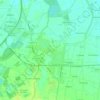
Pavia topographic map

Click on the map to display elevation.

Pavia

From an elevation point of view, the city has various heights. The highest point is located in the area of the Visconti Castle, about 80 m (260 ft) above sea level, and then slowly declines. From an altitude of 80 m (260 ft), you pass to 77 m (253 ft) in about 500 m (550 yd; 1,600 ft). Downstream from Piazza Vittoria, where the cardo and decumanus of the Roman city crossed, the slope becomes more pronounced, up to just under 60 m (200 ft) above sea level near the Ponte Coperto.

Wikipedia (CC-BY-SA 3.0)

About this map

Name: Pavia topographic map, elevation, terrain.

Location: Pavia, Lombardy, 27100, Italy (45.15574 9.09038 45.23331 9.24055)

Average elevation: 74 m

Minimum elevation: 50 m

Maximum elevation: 93 m

Other topographic maps

Click on a map to view its topography, its elevation and its terrain.

Coste

Italy > Lombardy > Pavia > San Cipriano Po

Average elevation: 60 m

San Genesio

Italy > Lombardy > Pavia > San Genesio ed Uniti

Average elevation: 85 m

Trebbio

Italy > Lombardy > Pavia > Torrazza Coste

Average elevation: 314 m

Castello

Italy > Lombardy > Pavia > Rocca de' Giorgi

Average elevation: 358 m

Torrazza

Italy > Lombardy > Pavia > Borgo San Siro

Average elevation: 97 m

Casale Staffora

Italy > Lombardy > Pavia

Average elevation: 1,265 m

Godiasco

Italy > Lombardy > Pavia > Godiasco Salice Terme

Average elevation: 294 m

Bressana

Italy > Lombardy > Pavia > Bressana Bottarone

Average elevation: 65 m

Nivione

Italy > Lombardy > Pavia

Average elevation: 553 m

Cegni

Italy > Lombardy > Pavia > Santa Margherita di Staffora

Average elevation: 927 m

Castello

Italy > Lombardy > Pavia > Rocca de' Giorgi

Average elevation: 358 m

Casino Soriasco

Italy > Lombardy > Pavia > Soriasco

Average elevation: 323 m

Cascina del Conte

Italy > Lombardy > Pavia > Voghera

Average elevation: 76 m

Po

Italy > Lombardy > Pavia > Pieve Albignola

Average elevation: 66 m

Torrazza

Italy > Lombardy > Pavia > Borgo San Siro

Average elevation: 97 m

Paravello

Italy > Lombardy > Pavia > Val di Nizza > Casa Ponte

Average elevation: 497 m

Parco del Ticinello

Italy > Lombardy > Pavia > Siziano

Average elevation: 91 m

Gear up for your next adventure:

💧Reusable Water Bottle - Durable water bottles for hydration on trails
🧶550 Survival Paracord - Versatile utility cord for emergency repairs and rigging
🔥Emergency Fire Starter - Reliable ignition source for all weather conditions
🧤Insulated Winter Gloves - Heavy-duty protection for sub-zero Canadian adventures
🔦LED Flashlight - Powerful and long-lasting flashlight for camping and emergencies

As an Amazon Associate, this site earns from qualifying purchases at no extra cost to you.