Geolocate

Gapan topographic map

Click on the map to display elevation.

About this map

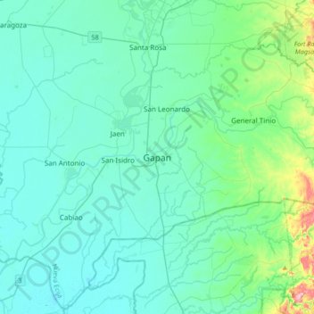
Name: Gapan topographic map, elevation, terrain.

Location: Gapan, Nueva Ecija, Central Luzon, 3105, Philippines (15.15228 120.78794 15.47228 121.10794)

Average elevation: 34 m

Minimum elevation: 2 m

Maximum elevation: 240 m

Other topographic maps

Click on a map to view its topography, its elevation and its terrain.

Llanera

Philippines > Nueva Ecija

Average elevation: 73 m

Palayan

Philippines > Nueva Ecija

Average elevation: 107 m

Quezon

Philippines > Nueva Ecija

Average elevation: 28 m

Gear up for your next adventure:

🥾Trail Hiking Socks - Comfortable socks to prevent blisters and fatigue
🧦Hiking Liner Socks - Thin base layer to prevent friction and blisters
🧥Fleece Jacket - Warm and lightweight jacket for layering
Bushcraft Tarp - Versatile emergency shelter or gear protection
🗺️Topographic Maps - Detailed maps to explore trails, mountains, and wilderness areas

As an Amazon Associate, this site earns from qualifying purchases at no extra cost to you.