
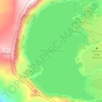
Nemrut Gölü topographic map
Interactive map
Click on the map to display elevation.
About this map
Name: Nemrut Gölü topographic map, elevation, terrain.
Location: Nemrut Gölü, Güroymak, Bitlis, Ostanatolien, Türkei (38.59636 42.20195 38.64590 42.24853)
Average elevation: 2,349 m
Minimum elevation: 2,045 m
Maximum elevation: 2,826 m
Other topographic maps
Click on a map to view its topography, its elevation and its terrain.
Ardahan
Türkei > Ostanatolien > Ardahan
Ardahan, Ardahan merkez, Ardahan, Ostanatolien, 75000, Türkei
Average elevation: 2,067 m
Hakkâri
Türkei > Ostanatolien > Hakkâri
Hakkâri, Hakkari merkez, Hakkari, Ostanatolien, 30000, Türkei
Average elevation: 2,280 m
Yayladere
Türkei > Ostanatolien > Yayladere
Yayladere, Bingöl, Ostanatolien, Türkei
Average elevation: 1,786 m