
Ardahan topographic map
Interactive map
Click on the map to display elevation.
About this map
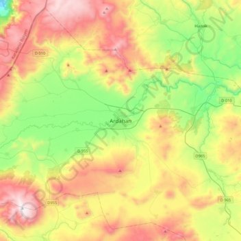
Name: Ardahan topographic map, elevation, terrain.
Location: Ardahan, Ardahan merkez, Ardahan, Ostanatolien, 75000, Türkei (40.95030 42.54356 41.27030 42.86356)
Average elevation: 2,067 m
Minimum elevation: 1,523 m
Maximum elevation: 2,804 m