Geolocate

Kisa topographic map

Click on the map to display elevation.

About this map

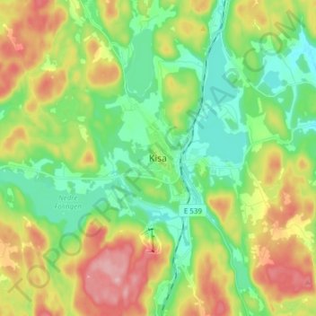
Name: Kisa topographic map, elevation, terrain.

Location: Kisa, Kinda kommun, Östergötland County, 590 37, Sweden (57.94750 15.58284 58.02750 15.66284)

Average elevation: 155 m

Minimum elevation: 88 m

Maximum elevation: 267 m

Other topographic maps

Click on a map to view its topography, its elevation and its terrain.

Kinda kommun

Sweden > Östergötland County

Average elevation: 133 m

Navestad

Sweden > Östergötland County > Norrköping

Average elevation: 34 m

Vadstena

Sweden > Östergötland County

Average elevation: 98 m

Illern

Sweden > Östergötland County > Linköping

Average elevation: 72 m

Nässja

Sweden > Östergötland County

Average elevation: 91 m

Halgen

Sweden > Östergötland County

Average elevation: 88 m

Mjölby kommun

Sweden > Östergötland County

Average elevation: 123 m

Boxholms kommun

Sweden > Östergötland County

Average elevation: 169 m

Järstad

Sweden > Östergötland County

Average elevation: 82 m

Gear up for your next adventure:

👟Sport Hiking Sandals - Breathable footwear for water crossings and camp rest
🪜Heavy Duty Carabiners - Multi-use clips for securing gear to your backpack
🧰Multitool Knife - Compact and versatile tool for outdoor use
🛏️Sleeping Bag - Warm and compact sleeping bags for outdoor camping
💧Hydration Bladder - Hands-free hydration solution for long treks

As an Amazon Associate, this site earns from qualifying purchases at no extra cost to you.