Geolocate

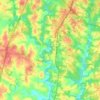
New Light topographic map

Click on the map to display elevation.

About this map
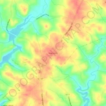
Name: New Light topographic map, elevation, terrain.

Location: New Light, Anderson County, South Carolina, 29677, United States (34.56927 -82.82292 34.60927 -82.78292)

Average elevation: 230 m

Minimum elevation: 199 m

Maximum elevation: 255 m

Other topographic maps

Click on a map to view its topography, its elevation and its terrain.
Belton

United States > South Carolina > Anderson County

Average elevation: 257 m

Iva

United States > South Carolina > Anderson County

Average elevation: 210 m

Starr

United States > South Carolina > Anderson County

Average elevation: 227 m

Pelzer

United States > South Carolina > Anderson County

Average elevation: 239 m

Pelzer

United States > South Carolina > Anderson County

Average elevation: 239 m

Starr

United States > South Carolina > Anderson County

Average elevation: 227 m

Pelzer

United States > South Carolina > Anderson County

Average elevation: 239 m

Belton

United States > South Carolina > Anderson County

Average elevation: 257 m

Gear up for your next adventure:

🧴Insect Repellent - Protect yourself from bugs during outdoor adventures
🛶Waterproof Dry Bags - Keep electronics and clothes dry during river crossings
🧥Waterproof Hiking Jacket - Protect yourself from rain and wind while hiking
🛏️Sleeping Bag - Warm and compact sleeping bags for outdoor camping
🔋Emergency Crank Radio - Weather alerts and power without needing batteries

As an Amazon Associate, this site earns from qualifying purchases at no extra cost to you.