Geolocate

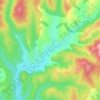
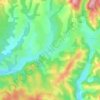
Ineu topographic map

Click on the map to display elevation.

About this map

Name: Ineu topographic map, elevation, terrain.

Location: Ineu, Arad, Romania (46.34958 21.78001 46.50917 21.92150)

Average elevation: 119 m

Minimum elevation: 99 m

Maximum elevation: 367 m

Other topographic maps

Click on a map to view its topography, its elevation and its terrain.

Căprioara

Romania > Arad

Average elevation: 216 m

Brusturi

Romania > Arad

Average elevation: 514 m

Belotinț

Romania > Arad

Average elevation: 190 m

Groșii Noi

Romania > Arad

Average elevation: 282 m

Adea

Romania > Arad

Average elevation: 95 m

Mihaiasa

Romania > Arad > Săvârșin

Average elevation: 527 m

Toc

Romania > Arad

Average elevation: 235 m

Târnova

Romania > Arad

Average elevation: 129 m

Munar

Romania > Arad

Average elevation: 101 m

Lupești

Romania > Arad

Average elevation: 278 m

Munar

Romania > Arad > Munar

Average elevation: 101 m

Obârșia

Romania > Arad

Average elevation: 437 m

Gear up for your next adventure:

🥾Hiking Shorts - Breathable shorts suitable for summer hikes
🥾Hiking Gaiters - Protect legs and shoes from mud, snow, and debris
🧭GPS Outdoor Watch - Smart watch for navigation and fitness tracking in nature
🥾All-Terrain Hiking Boots - Versatile boots for varied hiking conditions
🧦Hiking Socks - Moisture-wicking and comfortable socks for long hikes

As an Amazon Associate, this site earns from qualifying purchases at no extra cost to you.