Geolocate

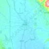
Kyungon topographic map

Click on the map to display elevation.

About this map

Name: Kyungon topographic map, elevation, terrain.

Location: Kyungon, Taungoo Township, Taungoo District, Bago Region, Myanmar (19.03592 96.35709 19.04864 96.37277)

Average elevation: 59 m

Minimum elevation: 54 m

Maximum elevation: 67 m

Other topographic maps

Click on a map to view its topography, its elevation and its terrain.

Ban Laung U Tu

Myanmar > Bago Region > Taungoo District

Average elevation: 49 m

Zayyawadi

Myanmar > Bago Region > Taungoo District

Average elevation: 46 m

Taungoo

Myanmar > Bago Region > Taungoo District

Three mountain ranges traverse the district—the Pegu Yomas, the Karen Hills, and the Nat Ma Taung or "Great Watershed"—all of which have a north and south direction, and are covered for the most part with dense forest. The Pegu Yomas have a general elevation of from 800 to 1,200 feet (240 to 370 m), while…

Average elevation: 47 m

Zayyawadi

Myanmar > Bago Region > Taungoo District

Average elevation: 46 m

Htantabin

Myanmar > Bago Region > Taungoo District

Average elevation: 41 m

Pyu

Myanmar > Bago Region > Taungoo District

Average elevation: 49 m

Gear up for your next adventure:

🥾Waterproof Trail Shoes - Shoes designed to handle wet terrain
🔥Emergency Fire Starter - Reliable ignition source for all weather conditions
🧥Thermal Layer - Insulating layer for cold outdoor conditions
🥾Waterproof Hiking Shoes - Durable shoes for wet and rugged trails
🥾Hiking Boots - Sturdy boots providing ankle support and traction on rugged trails

As an Amazon Associate, this site earns from qualifying purchases at no extra cost to you.