Geolocate

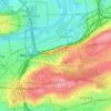
Krteň topographic map

Click on the map to display elevation.

About this map

Name: Krteň topographic map, elevation, terrain.

Location: Krteň, Třebonice, Praha 13, obvod Praha 5, Prague, 155 21, Czechia (50.03251 14.28241 50.05251 14.30241)

Average elevation: 359 m

Minimum elevation: 307 m

Maximum elevation: 398 m

Other topographic maps

Click on a map to view its topography, its elevation and its terrain.

obvod Praha 8

Czechia > Prague

Average elevation: 251 m

obvod Praha 6

Czechia > Prague

Average elevation: 313 m

obvod Praha 1

Czechia > Prague

Average elevation: 230 m

obvod Praha 2

Czechia > Prague

Average elevation: 224 m

obvod Praha 1

Czechia > Prague

Average elevation: 230 m

Praha 4

Czechia > Prague

Average elevation: 248 m

obvod Praha 1

Czechia > Prague

Average elevation: 230 m

obvod Praha 8

Czechia > Prague

Average elevation: 251 m

Prague Castle

Czechia > Prague

Average elevation: 244 m

obvod Praha 1

Czechia > Prague

Average elevation: 230 m

obvod Praha 1

Czechia > Prague

Average elevation: 230 m

Old Town

Czechia > Prague

Average elevation: 215 m

Praha-Kunratice

Czechia > Prague

Average elevation: 296 m

Žižkov

Czechia > Prague

Average elevation: 233 m

Old Town

Czechia > Prague

Average elevation: 216 m

Lesser Town

Czechia > Prague

Average elevation: 237 m

Lesser Town

Czechia > Prague

Average elevation: 237 m

Dolní Počernice

Czechia > Prague

Average elevation: 243 m

Gear up for your next adventure:

🧥Insulated Jacket - Keep warm in cold outdoor conditions
🥾Hiking Shorts - Breathable shorts suitable for summer hikes
🥾Mountaineering Boots - Supportive boots for climbing and high-altitude hiking
🌡️Emergency Mylar Blankets - Compact thermal protection for unexpected nights outdoors
🪑Ultralight Camping Stool - Compact seating for rest stops during long hikes

As an Amazon Associate, this site earns from qualifying purchases at no extra cost to you.