Geolocate

Old Town topographic map

Click on the map to display elevation.

About this map
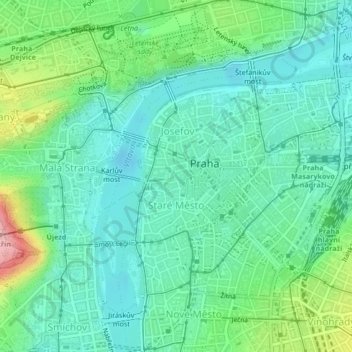
Name: Old Town topographic map, elevation, terrain.

Location: Old Town, obvod Praha 1, Prague, Czechia (50.07867 14.40898 50.09429 14.42847)

Average elevation: 216 m

Minimum elevation: 177 m

Maximum elevation: 326 m

Other topographic maps

Click on a map to view its topography, its elevation and its terrain.

Krteň

Czechia > Prague

Average elevation: 359 m

Gear up for your next adventure:

🧦Thermal Socks - Warm socks for winter hiking or camping
👟Trail Running Shoes - Agile footwear for fast-paced topographic exploration
⛺Tent Footprint - Protect tent floor and increase durability
🧴First Aid Kit - Essential first aid supplies for outdoor emergencies
🧢Hiking Hat - Sun-protective and breathable hats for long treks

As an Amazon Associate, this site earns from qualifying purchases at no extra cost to you.